

Independence Plaza
Neighborhood Association Meeting - Second Thursday of each month, 6:30 pm via Zoom
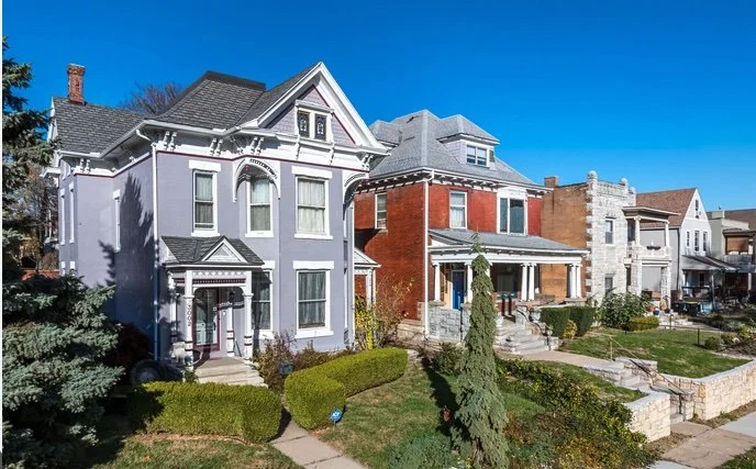
Independence Plaza is a Historic Northeast neighborhood just east of downtown Kansas City, generally bounded by Independence Avenue to the north, Benton Boulevard to the east, I-70 to the south, and Brooklyn (south of 9th Street) plus The Paseo (north of 9th Street) to the west. Its early growth is often traced to 1876, when Thomas Marty built a prominent home east of Troost, helping push development outward as Independence Avenue and Independence Boulevard became one of the city’s most fashionable residential corridors. Along that boulevard, captains of industry built large homes, and the neighborhood’s identity was reinforced by landmarks like the Bonaventure Hotel (built in 1886) and Independence Plaza Park, which was part of Kansas City’s influential 1893 park and boulevard plan led by landscape architect George Kessler and Park Board President August Meyer.
Over time, Independence Plaza evolved from an upper-class enclave into a more mixed, working and middle-class community while holding onto a strong sense of place and historic architecture. The area was reshaped by major infrastructure, including the expansion of The Paseo in 1899, which helped define today’s neighborhood edges and separated Independence Plaza from what is now Paseo West. Today, Independence Plaza is unique among Historic Northeast neighborhoods for its blend of residential blocks alongside commercial corridors and industrial uses, with proximity to Independence Avenue and Prospect Avenue, nearby parks, and the Kansas City University of Medicine and Biosciences campus.